Across Lincolnshire. Down To The Last Gate.
Homes, agricultural premises and commercial storage. Start with your postcode, then tell us how to reach the tank.
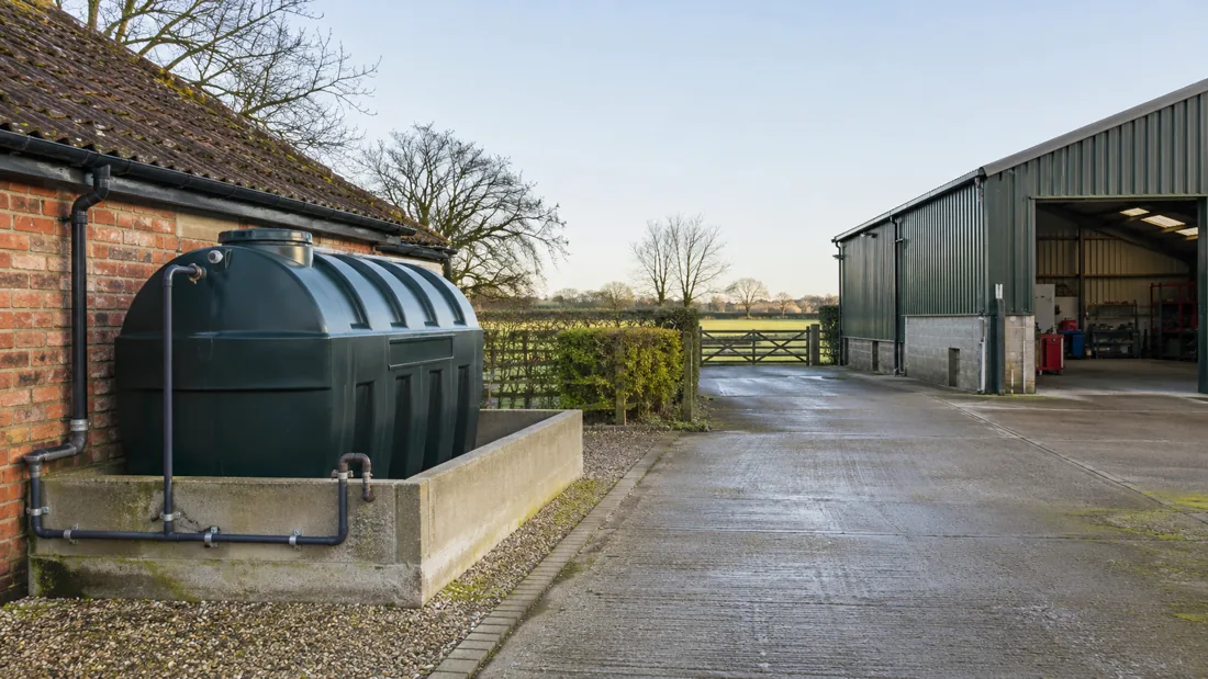
Tank enquiries across Lincolnshire, from the Wolds to the southern farming districts.
We welcome enquiries from Lincoln, Boston, Spalding, Holbeach, Sleaford, Louth, Horncastle, Market Rasen, Gainsborough, Grantham, Stamford, Bourne and Skegness, together with surrounding villages. The responding provider confirms coverage for your postcode, the tank type and the equipment needed. We do not present these locations as branch offices.
County coverage needs more than a map pin. The useful details are the route to the tank, the ground under it, nearby water and what the storage supplies. These regional notes explain what to include, rather than suggesting that every property in an area has the same conditions.
Lincoln And Surrounding Villages
The Environment Agency’s Lincoln flood warning area includes land near the River Witham and the Fossdyke Canal. It also identifies urban drainage features including Sincil Dyke and Boultham Drain.
For a tank enquiry, identify nearby drainage and give the actual access entrance rather than relying on a city postcode. Where a tank is behind an occupied property, show the passage, garden gate and any shared access that equipment must use.
Boston And The Lower Witham
Boston’s tidal barrier is on the River Haven, as described by the Environment Agency. The agency also describes the Lower Witham between Lincoln and Boston as fenland shaped by drainage works and embanked watercourses.
Describe any ditch or drain near the tank, not just a major river. If ground is wet or access crosses a bank or narrow bridge, flag it before vehicle arrangements are agreed. Flood defences do not replace a site-specific assessment of spill routes.
Spalding And Holbeach
South Holland’s agri-food setting is reflected in the South Lincolnshire Food Enterprise Zone at Holbeach. The council places the employment site north-west of Holbeach beside the A17/A151 junction.
For agricultural premises around Spalding and Holbeach, explain whether the storage supplies farmhouse heat, machinery or another business activity. Include seasonal yard traffic and the route from the main road to the working area. A nearby major junction does not describe the last stretch into a farmyard.
Sleaford And Rural North Kesteven
County council transport work identifies Sleaford routes using the A15 and A17, including approaches through Holdingham. These main-road connections sit alongside local streets and individual property entrances.
Send the correct entrance and any restriction on reaching the tank from it. A replacement in a rear garden may be governed by a narrow side passage, while an outlying property may need a vehicle turning assessment. Include photos of both the base and the complete route in.
Louth, Horncastle And Market Rasen
Louth sits on the edge of the Wolds, according to Louth Town Council. Horncastle is also on the Wolds’ edge, with the River Bain through its centre. Market Rasen lies on the western edge of this landscape.
The Wolds’ rolling chalk ground and dispersed farmhouses make individual access details useful. Tell us about slopes, narrow lanes and changes of level between the parking position and tank. Around a watercourse, show the tank’s relationship to nearby drainage without approaching an unsafe area.
Gainsborough And The Trent Side
The county transport study for Gainsborough identifies the River Trent and the A631 through the town. Its route analysis also describes the A156 south towards Lincoln.
Where storage is near water, include its surrounding surfaces and drainage in the enquiry. For a commercial yard, identify loading movements and the preferred vehicle entrance. The tank location alone does not show whether equipment can enter, set up and leave without disrupting other work.
Grantham, Stamford And Bourne
South Kesteven’s visitor service identifies the A1 near Grantham and Stamford and the main-line station at Grantham. National Highways also notes agricultural and individual-property access along the A1 corridor.
For sites around these towns and Bourne, give any approach restrictions and the entrance used by large vehicles. Keep the access description separate from a postal address. On mixed premises, identify each tank’s fuel use and whether other contractors need the same working space.
Skegness And Coastal Properties
The Environment Agency’s Lincolnshire coastal account describes a coastal flood plain extending inland. County council records also identify Skegness among the communities affected by historic North Sea flooding.
For a coastal or nearby rural tank, mention known flooding history and drainage beside the installation. Do not assume all properties share the same risk. A replacement position needs its own assessment, including stable support and access for future inspections.
Your Access Checklist
Include entrance width, surface type, overhead restrictions, turning space and the approximate distance from parking to the tank. Mention shared land or permissions, and send pictures of tight corners as well as the final position.
Read the guide for removal, replacement or cleaning before sending the request. Each explains which tank and fuel details are most useful.